TERRAIN FUNCTION - In the case of terrain or obstacle alert, the ND:
The ND displays the AUTO RANGE/MODE message.
If the aircraft is below 1 000 ft AGL, the TCAS mode is TA ONLY.
GPWS EXCESSIVE RATE OF DESCENT (MODE 1) - Mode 1 is inhibited when the aircraft is:
Airbus does not provide any specific value.
RMP 3 is not directly connected to the SURV. However, if the XPDR code is set from RMP 3, the RMP synchronization function enables RMP 1 or RMP 2 to transmit the code to the SURV.
The VD displays areas of windshear but only below 2,500 ft AGL.
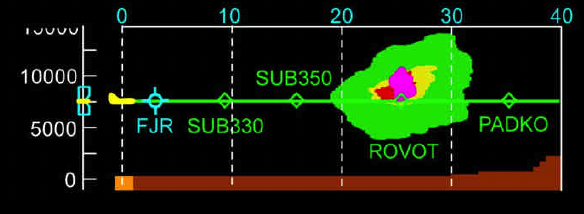
The VD does NOT display areas of windshear.
TURBULENCE DETECTION (TURB) FUNCTION - The ND and VD display the areas of turbulence in _____.
If the aircraft is below 1 650 ft AGL in descent, or 1 750 ft AGL in climb, the TCAS does not consider aircraft that are flying below 380 ft. These aircraft are considered to be on ground.
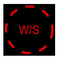
What does this indication mean?
The flight crew can select the ground mapping function via:

TURBULENCE DETECTION (TURB) FUNCTION - The TURB function detects clear air turbulence or dry turbulence.
The TURB function does NOT detect clear air turbulence or dry turbulence.
Advertisement
If the TERR function is operative, the VD continuously displays the terrain and it indicates the real location of the terrain. The zone elevation in amber is based on the measured radio-altimeter information. Appears when the aircraft:
When armed, the WXR will start to scan the envelope ahead of the aircraft if:
The TCAS detects intruders that are flying within a maximum altitude _____, the aircraft.
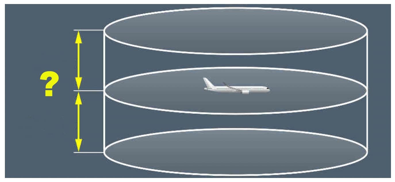
TERRAIN FUNCTION - PROTECTION and VERTICAL ENVELOPE - Warning and caution envelopes change, depending on:
The TCAS triggers a Traffic Advisory (TA) to indicate a possible collision threat. This advisory helps the flight crew to visually locate the intruder. It also prepares the flight crew for a possible RA. However, a TA may not always occur before an RA.
The WXR may not be able to discriminate the on-path and the off-path weather at ranges above 320 NM, because of the angle of the antenna beam width.
The WXR may not be able to discriminate the on-path and the off-path weather at ranges above 160 NM. The WXR could consider some off-path weather as on-path weather.
The WXR antenna scans:
The WXR takes into account the curvature of the earth, to display an image based on the mean sea level. It also reduces the ground returns from the displayed weather, by using the terrain data provided by the TAWS database.
When the aircraft receives a "Descend" type RA and goes below 1 000 ft AGL in descent, the vertical speed target is automatically changed to 0 fpm.
If the GPWS detects an excessive decrease in altitude after takeoff, or during a go-around, when the landing gear or the flaps are not in landing configuration, the following is triggered:
TURBULENCE DETECTION (TURB) FUNCTION - The turbulence detection (TURB) function detects wet turbulence in a volume of space ahead of the aircraft. The TURB detection function scans:
Advertisement
The VD always displays the terrain, even if the TERR pb is not pressed on the EFIS CP.
The SURV includes two identical surveillance systems, referred to as SYS 1 and SYS 2.
The aircraft has two combined TCAS/Mode S antennas that transmit and receive data to and from the TCAS and Air Traffic Control (ATC).

The aircraft has four combined TCAS/Mode S antennas.
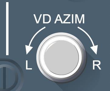
VD AZIM knob - The AZIM value is limited to _____ around the current heading.
If both RMP 1 and RMP 2 fail, the XPDR control remains available via the SURV/CONTROLS page of the MFD.
GPWS visual and audio indicators override stall or windshear alerts .
Stall or windshear alerts override GPWS visual and audio indicators.
The WXR does not detect:
The GPWS function detects terrain collision threats by comparing the geometric altitude of the aircraft and its trajectory with the information provided by the:
The WXR detects:
TCAS INTRUDER WITH NO REPORTED ALTITUDE - For intruders that do not report their altitude:
Advertisement
AUDIO INDICATORS - The "Weather Ahead" alert message (Synthetic Voice) The WXR triggers a weather ahead alert, weather or turbulence detected within _____ of flight.
The WXR is automatically shut down:
The WXR is automatically activated (will start to scan the envelope ahead of the aircraft) when engine takeoff power thrust is applied. However if the flight crew does not press the WX pb on the EFIS CP , there will be no display on the ND or the VD. The PWS and WX image will be displayed automatically on the ND and VD, only if windshear is detected.
If the aircraft approaches terrain with the landing gear up and the flaps extended for landing, the following is triggered:
The ground mapping function enables the flight crew to display a map of terrain features on the ND. The color code is:
WXR MANUAL GAIN MODE - The manual GAIN mode enables the flight crew to adjust sensitivity of the weather display on the ND. The flight crew can select the manual GAIN mode by using:
The TCAS detects intruders that are flying within a maximum range of _____ (depending on the aircraft configuration and external weather conditions),
In some circumstances, TCAS intruders may be detected up to 100 NM.
The Predictive Windshear (PWS) function detects windshears:
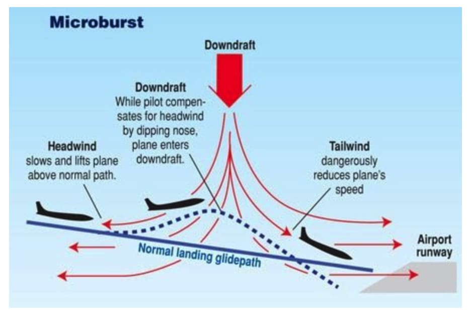
The PWS function can detect and display up to 8 different windshears simultaneously.
GPWS EXCESSIVE RATE OF DESCENT (MODE 1) - The descent rate data is the inertial vertical speed, or the barometric vertical speed, if the barometric vertical speed is not available.
This is the contrary: the descent rate data is the barometric vertical speed, or the inertial vertical speed, if the barometric vertical speed is not available.
AUDIO INDICATORS - The "Monitor Radar Display" alert message (Synthetic Voice) triggers a windshear caution, and the aircraft is not in a dangerous zone.
Advertisement
AUDIO INDICATORS - The "Windshear Ahead" alert message (Synthetic Voice) triggers a windshear warning during:
"Go Around, Windshear Ahead" (Synthetic Voice) is the PWS alert triggering a windshear warning during approach.
